sobre este lugar
El Yunque National Forest
📍 Luquillo
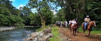
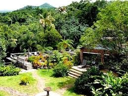
The only rainforest within the U.S. National Forest System receives an annual fluvial precipitation of almost 400 billion liters of rain. Its waterfalls, orchids, giant ferns, imposing tabonuco trees, and palms make it a true paradise for the photographer and nature lover. On El Yunque's main road, visitors will find La Coca waterfall and Yokahú Tower, an observation spot that looks over the rainforest's lush green vegetation and on to the east coast of the island. Stop by the rainforest's visit
dónde está
Ubicación & cómo llegar
Coordenadas exactas: 18.33985, -65.75993 · Municipio de Luquillo
dónde quedarte cerca
🏨 Ver hoteles cerca
Links afiliados — el precio para ti no cambia, al reservar nos ayudas a mantener el sitio.
Más Puentes, Lagos & Reservas cerca

desbloquea todo
2,004 rincones de PR en tu bolsillo
GPS exactos, rutas completas, fotos HD, costos reales y las guías que nos tomó años armar.
- Todas las coordenadas GPS exactas + 1-click a Waze/Maps
- Rutas curadas por nosotros: "Fin de semana en Utuado", "Chinchorreo Ruta 184", etc.
- Alertas de ofertas de vuelos antes que en IG
- Descarga el KML offline — navega sin data
Mensual$1.99por mes
Ahorras 16%Anual$19.99≈$1.67/mes